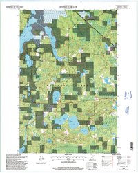
1996 Map of Tobique
USGS Topo · Published 1998About this map
Chippewa National Forest and the Indian Reservation dominate this mid-1990s terrain in Cass County, where a dense network of glacial lakes and waterways defines the landscape. The Boy River meanders through the western half, connecting Boy Lake and Inguadona Lake, while the Swift River cuts through the center toward Tobique Lake. This period of the 1990s shows the region's recreation and resource infrastructure, including a Boat Ramp at Mabel Lake and Boat Access (No Ramp) at Portage Lake, alongside active Gravel Pits and a Cemetery near the northern boundary. The intricate hydrography, featuring smaller bodies like Phelon, Wax, and Lost Girl Lake, reflects a classic Minnesota Northwoods environment managed for forest conservation and tribal land use.
Find a feature on this map
29 named features on this map. Tap any name to fly to it.
Don’t see what you’re looking for? This feature index may not catch every label — zoom into the map to look around manually.
Map Details
Editions of this 1996 Tobique Map
This is the sole edition of this map. No revisions or reprints were ever made.
Other maps of this area

1953 · Duluth
USGS Topo · 1:250,000

1953 · Brainerd
USGS Topo · 1:250,000

1954 · Bemidji
USGS Topo · 1:250,000

1954 · Hibbing
USGS Topo · 1:250,000

1957 · Brainerd
USGS Topo · 1:250,000

1957 · Bemidji
USGS Topo · 1:250,000

1957 · Hibbing
USGS Topo · 1:250,000

1958 · Bemidji
USGS Topo · 1:250,000

1958 · Hibbing
USGS Topo · 1:250,000

1958 · Brainerd
USGS Topo · 1:250,000