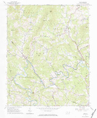
1966 Map of Todd
USGS Topo · Published 1984About this map
The South Fork New River meanders through the heart of the Blue Ridge in this mid-1960s survey, defining the rural landscape of southern Ashe Co and northern Watauga Co. The settlement of Todd serves as a local hub near the confluence of Elk Creek and the river, featuring the Elkland Sch and Blackburn Chapel. The topographic detail reveals a network of mountain communities and ridges, including Old Fields and Bald Mountain, where family-oriented history is preserved through numerous rural churches like Bethany Ch and Mission Home Ch. The map notably tracks the Railroad Grade Road as it follows the river's winding path toward Fleetwood, tracing the route of former rail infrastructure that once drove the local economy. From the elevations of Rich Mtn to the riverside flats at Brownwood, this survey captures a period of stable mountain life before modern development altered the character of these high-country corridors.
Find a feature on this map
59 named features on this map. Tap any name to fly to it.
Don’t see what you’re looking for? This feature index may not catch every label — zoom into the map to look around manually.
Map Details
Editions of this 1966 Todd Map
2 editions found
Other maps of this area

1889 · Wilkesboro
USGS Topo · 1:125,000

1891 · Wilkesboro
USGS Topo · 1:125,000

1893 · Cranberry
USGS Topo · 1:125,000

1895 · Cranberry
USGS Topo · 1:125,000

1899 · Cranberry
USGS Topo · 1:125,000

1902 · Cranberry
USGS Topo · 1:125,000

1934 · Boone
USGS Topo · 1:24,000

1935 · Baldwin Gap
USGS Topo · 1:24,000

1935 · Zionville
USGS Topo · 1:24,000

1936 · Blowing Rock
USGS Topo · 1:48,000