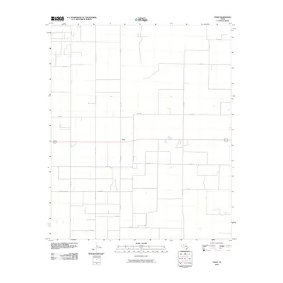
2010 Map of Tokio
USGS Topo · Published 2010About this map
Tokio serves as the central hub of this High Plains landscape, where the flat terrain is defined by a rigid grid of agricultural roads and irrigation infrastructure. The survey reveals a highly organized rural economy, with routes like 4-Mile Lateral Rd and County Line Rd delineating property and county divisions. This 2010 snapshot of Terry County shows the intersection of major thoroughfares such as Fm 1780 and local arteries including Co Rd 430 and Co Rd 121. The sparse placement of structures suggests a landscape dominated by large-scale farming, typical of the West Texas cotton-growing region during the early 21st century.
Find a feature on this map
19 named features on this map. Tap any name to fly to it.
Don’t see what you’re looking for? This feature index may not catch every label — zoom into the map to look around manually.
Map Details
Editions of this 2010 Tokio Map
This is the sole edition of this map. No revisions or reprints were ever made.
Other maps of this area

1954 · Brownfield
USGS Topo · 1:250,000

1958 · Brownfield
USGS Topo · 1:250,000

1962 · Brownfield
USGS Topo · 1:250,000

1969 · Gomez
USGS Topo · 1:24,000

1969 · Plains 1 SE
USGS Topo · 1:24,000

1969 · Pool
USGS Topo · 1:24,000

1969 · Wellman
USGS Topo · 1:24,000

1970 · Plains 1 SW
USGS Topo · 1:24,000

1970 · Tokio
USGS Topo · 1:24,000

1970 · Tokio NW
USGS Topo · 1:24,000