
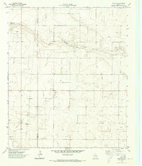
1970 Map of Tokio
USGS Topo · Published 1973About this map
The West Texas High Plains are defined by the intensive energy and resource infrastructure visible at the boundary of Yoakum Co Terry Co during the early 1970s. The small settlement of Tokio serves as a central hub in a landscape otherwise dominated by industrial extraction, notably within the Prentice Oil and Gas Field. This era of development is marked by a complex network of pipelines and a local Pumping Sta, which supported the regional oil economy across the flat, semi-arid terrain. Scattered Gravel Pits indicate active construction and road maintenance alongside the section-line roads. The map reveals the systematic subdivision of the Llano Estacado, where the grid-like distribution of oil wells and utility lines reflects a highly managed approach to land use and mineral rights characteristic of the South Plains.
Find a feature on this map
7 named features on this map. Tap any name to fly to it.
Don’t see what you’re looking for? This feature index may not catch every label — zoom into the map to look around manually.
Map Details
Editions of this 1970 Tokio Map
This is the sole edition of this map. No revisions or reprints were ever made.
Other maps of this area

1954 · Brownfield
USGS Topo · 1:250,000

1958 · Brownfield
USGS Topo · 1:250,000

1962 · Brownfield
USGS Topo · 1:250,000

1969 · Gomez
USGS Topo · 1:24,000

1969 · Plains 1 SE
USGS Topo · 1:24,000

1969 · Pool
USGS Topo · 1:24,000

1969 · Wellman
USGS Topo · 1:24,000

1970 · Plains 1 SW
USGS Topo · 1:24,000

1970 · Tokio NW
USGS Topo · 1:24,000
1970 · Tokio SE
USGS Topo · 1:24,000