
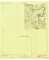
1931 Map of Tolar
USGS Topo · Published 1931About this map
The Brazos River carves a sharp, winding path through the heart of Hood County, defining the physical and economic geography of this North Texas region in the early 1930s. The settlement of Granbury sits prominently along the river's bend, serving as a focal point for the surrounding rural landscape. Nearby, Thorp Spring and the Fort Worth and Rio Grande railway illustrate the era's reliance on both water resources and steam-powered transportation.
Find a feature on this map
13 named features on this map. Tap any name to fly to it.
Don’t see what you’re looking for? This feature index may not catch every label — zoom into the map to look around manually.
Map Details
Editions of this 1931 Tolar Map
2 editions found
Other maps of this area

1889 · Granbury
USGS Topo · 1:125,000

1890 · Stephenville
USGS Topo · 1:125,000

1891 · Weatherford
USGS Topo · 1:125,000

1891 · Palo Pinto
USGS Topo · 1:125,000

1893 · Weatherford
USGS Topo · 1:125,000

1918 · Palo Pinto
USGS Topo · 1:125,000

1920 · Stephenville
USGS Topo · 1:125,000

1923 · Granbury 2-a
USGS Topo · 1:48,000

1923 · Granbury 1-b
USGS Topo · 1:48,000

1924 · Weatherford 3-d
USGS Topo · 1:48,000