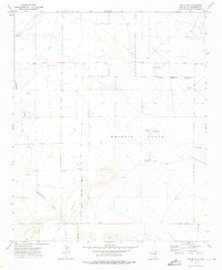
1973 Map of Tolar SE
USGS Topo · Published 1976About this map
Melrose Range dominates this portion of Roosevelt County, where the high plains terrain meets specialized military infrastructure. Mapping conducted in the early 1970s reveals a landscape characterized by isolation and utility, defined largely by the Military Reservation Boundary and the prominent escarpment of The Mesa. The distribution of water sources is critical in this arid environment, marked by scattered Wells, Fowler Well, and the West Jog Windmills. Evidence of aerial surveillance or training is visible through multiple Observation Tower sites located within the range. Along the southern portion of the map, Chapman Draw carves a natural drainage path across the high ground. The presence of a Drill Hole and various fences indicates ongoing land use and resource exploration on these plains during the post-war era.
Find a feature on this map
14 named features on this map. Tap any name to fly to it.
Don’t see what you’re looking for? This feature index may not catch every label — zoom into the map to look around manually.
Map Details
Editions of this 1973 Tolar SE Map
2 editions found
Other maps of this area

1954 · Clovis
USGS Topo · 1:250,000

1957 · Melrose
USGS Topo · 1:62,500

1958 · Clovis
USGS Topo · 1:250,000

1973 · Tolar
USGS Topo · 1:24,000

1973 · Krider
USGS Topo · 1:24,000

1973 · Melrose West
USGS Topo · 1:24,000

1973 · Tule Lake
USGS Topo · 1:24,000
1973 · Gammil Well
USGS Topo · 1:24,000

1973 · Gammil Well NE
USGS Topo · 1:24,000

1973 · Upton
USGS Topo · 1:24,000