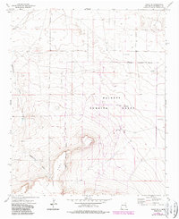
1973 Map of Tolar SE
USGS Topo · Published 1987About this map
The Melrose Bombing Range dominates this landscape in Roosevelt County, its presence clearly defined by the Military Reservation Boundary that carves through the High Plains terrain. Established within a region of traditional ranching and livestock infrastructure, the range is marked by technical features including a dedicated Observation Tower and numerous local water sources like West Jog Windmills. The southern portion of the survey is defined by the prominent rise of The Mesa, which creates a distinct topographic break from the surrounding flats.
Find a feature on this map
9 named features on this map. Tap any name to fly to it.
Don’t see what you’re looking for? This feature index may not catch every label — zoom into the map to look around manually.
Map Details
Editions of this 1973 Tolar SE Map
2 editions found
Other maps of this area

1954 · Clovis
USGS Topo · 1:250,000

1957 · Melrose
USGS Topo · 1:62,500

1958 · Clovis
USGS Topo · 1:250,000

1973 · Tolar
USGS Topo · 1:24,000

1973 · Krider
USGS Topo · 1:24,000

1973 · Melrose West
USGS Topo · 1:24,000

1973 · Tule Lake
USGS Topo · 1:24,000
1973 · Gammil Well
USGS Topo · 1:24,000

1973 · Gammil Well NE
USGS Topo · 1:24,000

1973 · Upton
USGS Topo · 1:24,000