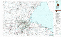
1986 Map of Toledo
USGS Topo · Published 1986About this map
Toledo and the western shores of Lake Erie dominate this mid-1980s survey, showing a landscape defined by the intersection of major industrial waterways and heavy rail infrastructure. The Maumee River and River Raisin serve as the primary drainage and shipping arteries, while the city center is encircled by the Toledo Terminal RR and lines of the Conrail system. This era captures the heavy transport network before significant late-century shifts, with Metcalf Field and Toledo Express Airport anchoring the region's aviation hubs.
Find a feature on this map
158 named features on this map. Tap any name to fly to it.
Don’t see what you’re looking for? This feature index may not catch every label — zoom into the map to look around manually.
Map Details
Editions of this 1986 Toledo Map
2 editions found
Other maps of this area

1900 · Maumee Bay
USGS Topo · 1:62,500

1900 · Toledo
USGS Topo · 1:62,500

1900 · Oak Harbor
USGS Topo · 1:62,500

1901 · Put-In-Bay
USGS Topo · 1:62,500

1901 · Bellevue
USGS Topo · 1:62,500

1901 · Bowling Green
USGS Topo · 1:62,500

1901 · Fremont
USGS Topo · 1:62,500

1901 · Elmore
USGS Topo · 1:62,500

1902 · Ypsilanti
USGS Topo · 1:62,500

1903 · Bellevue
USGS Topo · 1:62,500