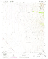
1952 Map of Tome SE
USGS Topo · Published 1980About this map
Large Spanish land grants define the geography of this Valencia County landscape, where the Tome Grant, Casa Colorada Grant, and Belen Grant meet. This mid-century survey, with revisions from the late 1970s, captures the transition from the high slopes of the Manzano Mountains and the Cibola National Forest down toward the valley floor. The map highlights the essential infrastructure of a semi-arid region, including a levee, a cross-country Pipeline, and isolated water sources like North Well, Mountain Well, and a strategically placed Windmill. Transportation and industry are marked by the A T & S F railroad corridor cutting through the southwestern corner, providing a clear view of the land use patterns that shaped this portion of New Mexico before more modern development altered the historic grant boundaries.
Find a feature on this map
16 named features on this map. Tap any name to fly to it.
Don’t see what you’re looking for? This feature index may not catch every label — zoom into the map to look around manually.
Map Details
Editions of this 1952 Tome SE Map
4 editions found
Other maps of this area

1916 · La Joya
USGS Topo · 1:125,000

1917 · Estancia
USGS Topo · 1:125,000

1952 · Tome SE
USGS Topo · 1:24,000

1952 · Black Butte
USGS Topo · 1:24,000

1952 · Tome NE
USGS Topo · 1:24,000

1952 · Turn
USGS Topo · 1:24,000

1952 · Tome
USGS Topo · 1:24,000

1952 · Becker
USGS Topo · 1:24,000

1954 · Capilla Peak
USGS Topo · 1:24,000

1954 · Torreon
USGS Topo · 1:62,500