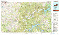
1985 Map of Tompkinsville
USGS Topo · Published 1994About this map
Tompkinsville serves as a central hub in this mid-1980s landscape, which spans the border between south-central Kentucky and northern Tennessee. The region is defined by the winding course of the Cumberland River, which feeds into the expansive Dale Hollow Lake and Lake Cumberland. A distinct network of ridges, such as Harvey Ridge and Tooley Ridge, dictates the placement of smaller settlements like Summer Shade, Flippin, and Emberton.
Find a feature on this map
184 named features on this map. Tap any name to fly to it.
Don’t see what you’re looking for? This feature index may not catch every label — zoom into the map to look around manually.
Map Details
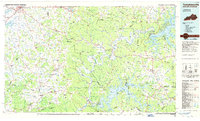
Editions of this 1985 Tompkinsville Map
2 editions found
Other maps of this area

1895 · Wartburg
USGS Topo · 1:125,000

1896 · Wartburg
USGS Topo · 1:125,000

1897 · Standingstone
USGS Topo · 1:125,000

1898 · Standingstone
USGS Topo · 1:125,000

1911 · Monticello
USGS Topo · 1:62,500

1914 · Monticello
USGS Topo · 1:62,500

1922 · Mammoth Cave
USGS Topo · 1:62,500

1923 · Mammoth Cave
USGS Topo · 1:62,500

1924 · Lillydale
USGS Topo · 1:62,500

1925 · Gainesboro
USGS Topo · 1:62,500