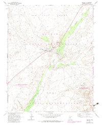
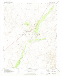
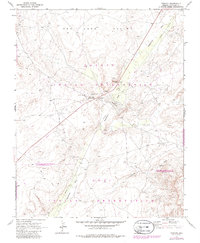
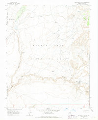
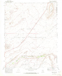
1970 Map of Tonalea
USGS Topo · Published 1983About this map
Tonalea and the Red Lake post office serve as the primary landmarks in this 1970 landscape, where the Navajo Indian Reservation and Hopi Indian Reservation meet. The map documents a period of administrative and topographical transition, clearly marking the Old Indian Reservation Boundary alongside more modern infrastructure like the prominent north-south Pipeline.
Find a feature on this map
23 named features on this map. Tap any name to fly to it.
Don’t see what you’re looking for? This feature index may not catch every label — zoom into the map to look around manually.
Map Details
Editions of this 1970 Tonalea Map
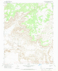
Other maps of this area

1883 · Marsh Pass
USGS Topo · 1:250,000

1886 · Echo Cliffs
USGS Topo · 1:250,000

1891 · Echo Cliffs
USGS Topo · 1:250,000

1892 · Marsh Pass
USGS Topo · 1:250,000

1956 · Marble Canyon
USGS Topo · 1:250,000

1959 · Marble Canyon
USGS Topo · 1:250,000

1961 · Marble Canyon
USGS Topo · 1:250,000
1967 · Pillars of Hercules
USGS Topo · 1:24,000
1967 · Begashibito Canyon
USGS Topo · 1:24,000
1969 · Tuba City NE
USGS Topo · 1:24,000