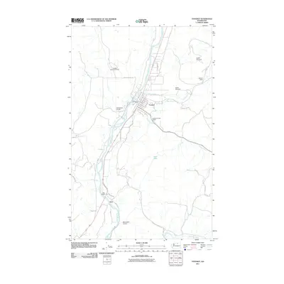
2011 Map of Tonasket
USGS Topo · Published 2011About this map
The Okanogan River corridor defines this northern Washington landscape, serving as the primary artery for settlement and transport near Tonasket. This 2011 survey illustrates the town's organization around the Tonasket Post Office and a grid of residential streets including Joseph Ave and Division St E, while the Tonasket Municipal Airport occupies the benchland to the northwest. The terrain transitions from the river valley into significant geological features like Whitestone Coulee and McLoughlin Canyon. To the south, the small settlement of Janis is marked by the Janis Bridge crossing. Several prominent peaks, including Horse Mountain and Duffys Mountain, overlook the Antoine Valley, while water bodies like Perry Lake and tributaries such as Bonaparte Creek provide a clear view of the region's complex drainage system.
Find a feature on this map
44 named features on this map. Tap any name to fly to it.
Don’t see what you’re looking for? This feature index may not catch every label — zoom into the map to look around manually.
Map Details
Editions of this 2011 Tonasket Map
This is the sole edition of this map. No revisions or reprints were ever made.
Other maps of this area

1902 · Osoyoos
USGS Topo · 1:125,000

1904 · Osoyoos
USGS Topo · 1:125,000

1906 · Chopaka
USGS Topo · 1:125,000

1954 · Okanogan
USGS Topo · 1:250,000

1956 · Loomis
USGS Topo · 1:62,500

1957 · Conconully
USGS Topo · 1:62,500

1957 · Tonasket
USGS Topo · 1:62,500

1957 · Oroville
USGS Topo · 1:62,500

1958 · Okanogan
USGS Topo · 1:250,000
1980 · Keystone
USGS Topo · 1:24,000