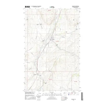
2017 Map of Tonasket
USGS Topo · Published 2017About this map
The Okanogan River corridor defines the valley floor here, serving as the central artery for transportation and settlement in this portion of Okanogan County. The town of Tonasket sits at a geographic crossroads where the river meets Bonaparte Creek, marked by the Bonaparte Creek Bridge. To the south, the smaller settlement of Janis is situated near the Janis Bridge, highlighting the importance of river crossings for the local road network.
Find a feature on this map
58 named features on this map. Tap any name to fly to it.
Don’t see what you’re looking for? This feature index may not catch every label — zoom into the map to look around manually.
Map Details
Editions of this 2017 Tonasket Map
This is the sole edition of this map. No revisions or reprints were ever made.
Other maps of this area

1902 · Osoyoos
USGS Topo · 1:125,000

1904 · Osoyoos
USGS Topo · 1:125,000

1906 · Chopaka
USGS Topo · 1:125,000

1954 · Okanogan
USGS Topo · 1:250,000

1956 · Loomis
USGS Topo · 1:62,500

1957 · Conconully
USGS Topo · 1:62,500

1957 · Tonasket
USGS Topo · 1:62,500

1957 · Oroville
USGS Topo · 1:62,500

1958 · Okanogan
USGS Topo · 1:250,000
1980 · Keystone
USGS Topo · 1:24,000