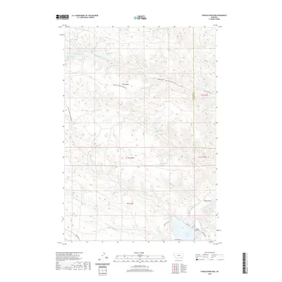
2020 Map of Tongue River Dam
USGS Topo · Published 2020About this map
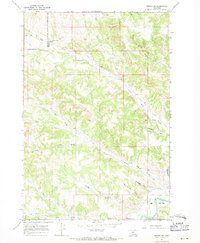
The Tongue River Reservoir and its associated Tongue River Dam anchor the southeastern corner of this landscape in Rosebud and Big Horn Counties. This 2020 topographical study captures a high-plateau environment defined by a dense network of water sources and seasonal drainage systems, including the Tongue River and various forks of Fourmile Cr. The map details numerous specific springs, such as 07S40E07DADD01 Spring and 07S40E11BADC01 Spring, which reveal the hydrological patterns necessary for livestock and land use in this arid region. Transportation across the ridgelines and draws is facilitated by Montana Secondary Highway 566 and a network of rural routes like Tongue Dam Rd and Deer Creek Rd. Significant landmarks such as Barber Draw and Leaf Rock Cr help define the varied elevation and drainage basins flowing toward the reservoir.
Find a feature on this map
38 named features on this map. Tap any name to fly to it.
Don’t see what you’re looking for? This feature index may not catch every label — zoom into the map to look around manually.
Map Details
Editions of this 2020 Tongue River Dam Map
This is the sole edition of this map. No revisions or reprints were ever made.
Other maps of this area

1954 · Hardin
USGS Topo · 1:250,000

1957 · Hardin
USGS Topo · 1:250,000

1958 · Hardin
USGS Topo · 1:250,000

1967 · Holmes Ranch
USGS Topo · 1:24,000

1967 · Tongue River Dam
USGS Topo · 1:24,000

1967 · Kirby
USGS Topo · 1:24,000
1967 · Spring Gulch
USGS Topo · 1:24,000
1967 · Pearl School
USGS Topo · 1:24,000
1967 · Taintor Desert
USGS Topo · 1:24,000
1967 · Birney SW
USGS Topo · 1:24,000