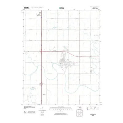
2009 Map of Tonkawa
USGS Topo · Published 2009About this map
Tonkawa sits along a significant bend of the Salt Fork Arkansas River, an area where the river's meandering course defines the southern edge of the settlement. The 2009 landscape is a grid of section-line roads and agriculture, interrupted by the industrial footprint of the West Autwine Oil Field to the northeast. To the north, the Blackwell-Tonkawa Municipal Airport serves as a regional hub, while the modern transportation corridor of the Fountain Road Interchange facilitates travel through the southern Oklahoma plains.
Find a feature on this map
22 named features on this map. Tap any name to fly to it.
Don’t see what you’re looking for? This feature index may not catch every label — zoom into the map to look around manually.
Map Details
Editions of this 2009 Tonkawa Map
This is the sole edition of this map. No revisions or reprints were ever made.
Other maps of this area

1955 · Enid
USGS Topo · 1:250,000

1958 · Enid
USGS Topo · 1:250,000

1968 · Billings
USGS Topo · 1:24,000

1968 · Tonkawa SE
USGS Topo · 1:24,000

1968 · Marland
USGS Topo · 1:24,000

1968 · Ponca City NW
USGS Topo · 1:24,000

1968 · Eddy
USGS Topo · 1:24,000

1968 · Nardin
USGS Topo · 1:24,000

1968 · Tonkawa
USGS Topo · 1:24,000

1968 · Blackwell
USGS Topo · 1:24,000