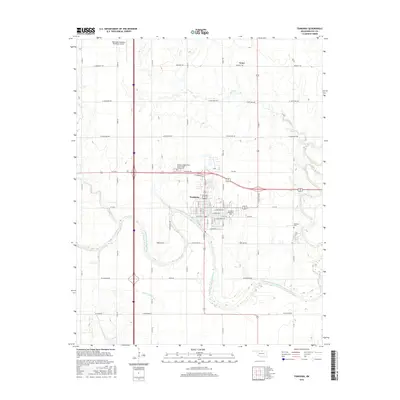
2016 Map of Tonkawa
USGS Topo · Published 2016About this map
Tonkawa sits prominently within a massive meander of the Salt Fork Arkansas River, an area where the Northern Oklahoma prairie is dissected by various drainages such as Birds-Nest Cr and Stink Cr. The town is the geographic and cultural heart of this 2016 survey, featuring the campus of Northern Oklahoma Coll and the historic Tonkawa Cem. To the north, the smaller community of Tyner appears near Stink Cr, while the regional infrastructure is anchored by the Blackwell-Tonkawa Municipal Airport in the northwest corner. A notable genealogical landmark is the Tonkawa Independent Order of Odd Fellows Cem, located just west of the main town site. The landscape is defined by the sharp contrast between the winding river bottomlands and the rigid grid of rural sections, including uniquely named routes like Yellow Bull Rd.
Find a feature on this map
63 named features on this map. Tap any name to fly to it.
Don’t see what you’re looking for? This feature index may not catch every label — zoom into the map to look around manually.
Map Details
Editions of this 2016 Tonkawa Map
This is the sole edition of this map. No revisions or reprints were ever made.
Other maps of this area

1955 · Enid
USGS Topo · 1:250,000

1958 · Enid
USGS Topo · 1:250,000

1968 · Billings
USGS Topo · 1:24,000

1968 · Tonkawa SE
USGS Topo · 1:24,000

1968 · Marland
USGS Topo · 1:24,000

1968 · Ponca City NW
USGS Topo · 1:24,000

1968 · Eddy
USGS Topo · 1:24,000

1968 · Nardin
USGS Topo · 1:24,000

1968 · Tonkawa
USGS Topo · 1:24,000

1968 · Blackwell
USGS Topo · 1:24,000