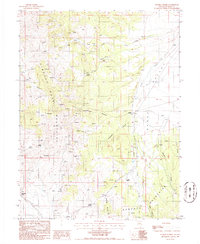
1986 Map of Tonkin Summit
USGS Topo · Published 1986About this map
The Simpson Park Mountains and Roberts Mountains dominate this high-desert landscape in central Nevada, partitioned by the wide floor of Denay Valley. This mid-1980s provisional survey shows a region defined by its water sources and mining exploration, with numerous unnamed Prospects dotting the slopes of Rooster Canyon and Pat Canyon. Scattered ranching and transit points like Indian Ranch and the small settlement of Tonkin provide human anchor points in the vast basin-and-range topography.
Find a feature on this map
24 named features on this map. Tap any name to fly to it.
Don’t see what you’re looking for? This feature index may not catch every label — zoom into the map to look around manually.
Map Details
Editions of this 1986 Tonkin Summit Map
This is the sole edition of this map. No revisions or reprints were ever made.
Other maps of this area

1926 · Roberts Mountains
USGS Topo · 1:250,000

1929 · Roberts Mountains
USGS Topo · 1:250,000

1938 · Cortez
USGS Topo · 1:48,000

1944 · Cortez
USGS Topo · 1:62,500

1949 · Roberts Creek Mtn
USGS Topo · 1:62,500

1951 · Roberts Creek Mtn
USGS Topo · 1:62,500

1955 · Millett
USGS Topo · 1:250,000

1955 · Winnemucca
USGS Topo · 1:250,000

1956 · Walti Hot Springs
USGS Topo · 1:62,500

1957 · Horse Creek Valley
USGS Topo · 1:62,500