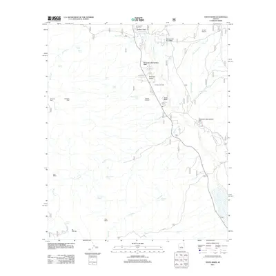
2011 Map of Tonto Basin
USGS Topo · Published 2011About this map
Tonto Creek flows southward through this high-desert landscape, anchoring a series of small residential developments and service hubs in the early twenty-first century. The small community of Punkin Center serves as a northern focal point, complete with the Punkin Center Post Office, while Tonto Basin and its own Tonto Basin Post Office sit further down the valley. The map reveals a pattern of dispersed settlement along the valley floor, including Riverside Acres and the separate eastern and western sections of Roosevelt Lake Gardens West.
Find a feature on this map
40 named features on this map. Tap any name to fly to it.
Don’t see what you’re looking for? This feature index may not catch every label — zoom into the map to look around manually.
Map Details
Editions of this 2011 Tonto Basin Map
This is the sole edition of this map. No revisions or reprints were ever made.
Other maps of this area

1907 · Roosevelt
USGS Topo · 1:125,000

1909 · Four Peaks
USGS Topo · 1:125,000

1912 · Roosevelt
USGS Topo · 1:125,000

1954 · Mesa
USGS Topo · 1:250,000

1957 · Mesa
USGS Topo · 1:250,000

1958 · Mesa
USGS Topo · 1:250,000

1960 · Mesa
USGS Topo · 1:250,000
1963 · Mine Mountain
USGS Topo · 1:24,000

1964 · Mesa
USGS Topo · 1:250,000
1964 · Kayler Butte
USGS Topo · 1:24,000
Featured Places
- Punkin Center, AZ
- Rancho Del Escondido, AZ
- Riverside Acres, AZ
- Roosevelt Lake Gardens East, AZ
- Tonto Basin, AZ