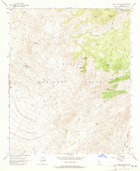
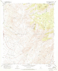
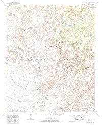
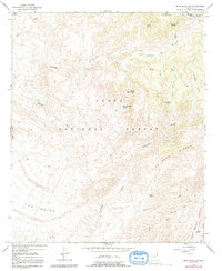
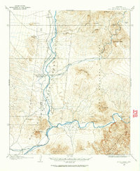
1963 Map of Mine Mountain
USGS Topo · Published 1965About this map
Mine Mountain and the surrounding high desert of the Tonto National Forest are defined by a complex network of pack trails and ephemeral water sources. In the early 1960s, this area of the Mazatzal Mts along the Gila and Maricopa County line remained largely roadless, accessible primarily via routes like the Soldier Camp Trail and the Mountain Trail. Settlement is sparse, represented by the remote Cline Cabin, suggesting a landscape utilized for seasonal ranching or prospecting rather than permanent habitation.
Find a feature on this map
33 named features on this map. Tap any name to fly to it.
Don’t see what you’re looking for? This feature index may not catch every label — zoom into the map to look around manually.
Map Details
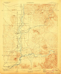
Editions of this 1963 Mine Mountain Map
4 editions found
Other maps of this area
1904 · Ft. McDowell
USGS Topo · 1:62,500
1906 · Ft. McDowell
USGS Topo · 1:62,500

1907 · Roosevelt
USGS Topo · 1:125,000

1909 · Four Peaks
USGS Topo · 1:125,000

1912 · Roosevelt
USGS Topo · 1:125,000

1930 · Cave Creek
USGS Topo · 1:125,000

1939 · Cave Creek
USGS Topo · 1:125,000

1954 · Mesa
USGS Topo · 1:250,000

1957 · Mesa
USGS Topo · 1:250,000

1958 · Mesa
USGS Topo · 1:250,000