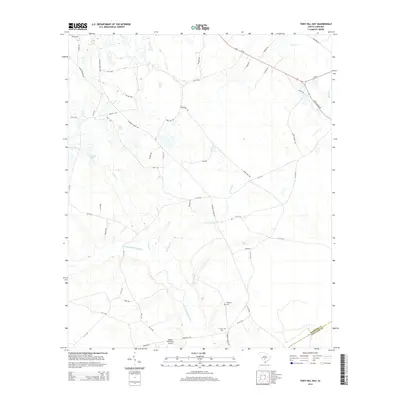
2014 Map of Tony Hill Bay
USGS Topo · Published 2014About this map
Tony Hill Bay and the surrounding Lowcountry wetlands of Colleton County are defined by a complex network of blackwater streams and small ponds. The Little Salkehatchie River meanders through the southern portion of the quadrangle, joined by tributaries such as Drawdy Br and Hurricane Br. This 2014 survey captures a rural landscape where local history is preserved in sites like Prospect Cem and Carter Cem, which are located near the intersection of Hunters Chapel Rd and Ehrhardt RD. The area's transport and infrastructure are represented by the Shiloh Plantation Airport and a mix of primary routes like Us-78 and secondary paths such as Natures Trl. The map illustrates the boundary between Bamberg Co and Colleton Co, showing how natural features like Lemon Cr and Brier Cr influence property and political divisions in this corner of South Carolina.
Find a feature on this map
57 named features on this map. Tap any name to fly to it.
Don’t see what you’re looking for? This feature index may not catch every label — zoom into the map to look around manually.
Map Details
Editions of this 2014 Tony Hill Bay Map
This is the sole edition of this map. No revisions or reprints were ever made.
Other maps of this area

1919 · Olar
USGS Topo · 1:62,500

1919 · Bamberg
USGS Topo · 1:48,000

1919 · Lodge
USGS Topo · 1:62,500

1920 · Lodge
USGS Topo · 1:48,000

1920 · Bamberg
USGS Topo · 1:62,500

1920 · Orangeburg
USGS Topo · 1:48,000

1921 · Orangeburg
USGS Topo · 1:62,500

1921 · Lodge
USGS Topo · 1:62,500

1943 · Olar
USGS Topo · 1:62,500

1943 · Lodge
USGS Topo · 1:62,500