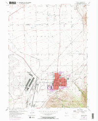
1955 Map of Tooele
USGS Topo · Published 1970About this map
The Tooele Ordnance Depot dominates the southwestern landscape of this mid-century survey, its massive grid of bunkers and rail spurs marking a significant military presence in the Tooele Valley. The city of Tooele itself shows substantial growth at the base of the Oquirrh Mountains, with civic life centered around the Court House, City Hall, and schools like Sterling Harris Sch. This era captures the transition from a rail-dependent economy to an automotive one, featuring both the Union Pacific and Western Pacific lines alongside a Drive-in Theater and the Municipal Airport. Smaller settlements like Erda and Lincoln dot the northern valley, while the mountainside is etched with mining Prospect labels and the peaks of One O'Clock and Two O'Clock, providing a clear look at the region before late-20th-century suburban expansion.
Find a feature on this map
51 named features on this map. Tap any name to fly to it.
Don’t see what you’re looking for? This feature index may not catch every label — zoom into the map to look around manually.
Map Details
Editions of this 1955 Tooele Map
3 editions found

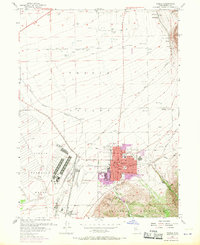
Other maps of this area

1885 · Tooele Valley
USGS Topo · 1:250,000

1915 · Fairfield
USGS Topo · 1:62,500

1917 · Fairfield
USGS Topo · 1:62,500

1918 · Stockton
USGS Topo · 1:62,500

1952 · Bingham Canyon
USGS Topo · 1:24,000

1952 · Garfield
USGS Topo · 1:24,000

1953 · Tooele
USGS Topo · 1:250,000

1955 · Mills Junction
USGS Topo · 1:24,000

1955 · Burmester
USGS Topo · 1:24,000

1955 · Grantsville
USGS Topo · 1:24,000