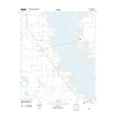
2011 Map of Tool
USGS Topo · Published 2011About this map
Cedar Creek Reservoir dominates this East Texas landscape, shaping the development and layout of several prominent lakeside communities during the early 21st century. The uniquely named Gun Barrel City sits on the eastern shore, characterized by dense residential street grids and finger-like peninsulas extending into the water. To the southwest, the smaller settlements of Seven Points and Tool serve as hubs along the primary roads.
Find a feature on this map
61 named features on this map. Tap any name to fly to it.
Don’t see what you’re looking for? This feature index may not catch every label — zoom into the map to look around manually.
Map Details
Editions of this 2011 Tool Map
This is the sole edition of this map. No revisions or reprints were ever made.
Other maps of this area

1920 · Kemp
USGS Topo · 1:62,500

1954 · Dallas
USGS Topo · 1:250,000

1957 · Kemp
USGS Topo · 1:62,500

1958 · Dallas
USGS Topo · 1:250,000

1960 · Tool
USGS Topo · 1:24,000

1960 · Mabank
USGS Topo · 1:24,000

1960 · Malakoff
USGS Topo · 1:24,000

1960 · Grays Prairie
USGS Topo · 1:24,000

1961 · Kemp
USGS Topo · 1:24,000

1961 · Kerens
USGS Topo · 1:24,000