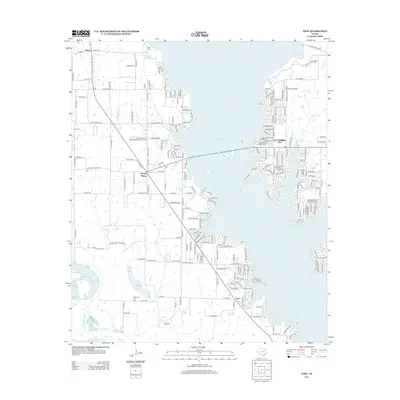
2012 Map of Tool
USGS Topo · Published 2012About this map
Gun Barrel City and the neighboring community of Tool occupy a jagged, peninsula-laden shoreline along the eastern edge of the Cedar Cr Reservoir. This 2012 survey documents a landscape defined by intensive residential development along the water, where intricate street networks like those in Timber Creek Est contrast with the older, grid-based agricultural patterns further west near Aley and Tolosa. The map captures the specialized infrastructure of the region, including the Gun Barrel City Airpark and the industrial footprint of the Flag Lake Oil Field. To the southwest, the terrain transitions into the lowlands of the Trinity River basin, marked by Flag Lake and Mud Lake. Local heritage is anchored by sites like Baker Cem and King Cem, while crossroads like Seven Points serve as the connecting hubs for the various lakeside developments.
Find a feature on this map
213 named features on this map. Tap any name to fly to it.
Don’t see what you’re looking for? This feature index may not catch every label — zoom into the map to look around manually.
Map Details
Editions of this 2012 Tool Map
This is the sole edition of this map. No revisions or reprints were ever made.
Other maps of this area

1920 · Kemp
USGS Topo · 1:62,500

1954 · Dallas
USGS Topo · 1:250,000

1957 · Kemp
USGS Topo · 1:62,500

1958 · Dallas
USGS Topo · 1:250,000

1960 · Tool
USGS Topo · 1:24,000

1960 · Mabank
USGS Topo · 1:24,000

1960 · Malakoff
USGS Topo · 1:24,000

1960 · Grays Prairie
USGS Topo · 1:24,000

1961 · Kemp
USGS Topo · 1:24,000

1961 · Kerens
USGS Topo · 1:24,000