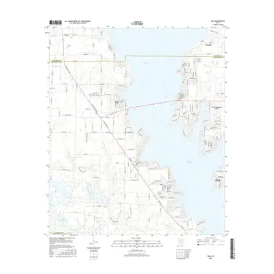
2016 Map of Tool
USGS Topo · Published 2016About this map
Cedar Cr Reservoir dominates this landscape on the Henderson and Kaufman County line, where mid-century water management projects reshaped the local geography. The shoreline is heavily developed with residential enclaves and streets radiating from Gun Barrel City and Seven Points, reflecting the area's transition into a major regional recreation and residential hub. Near the northern reach of the water, the community of Tolosa sits among a network of rural roads like Harris Ln and Co Rd 4044, while the Kaufman Co Henderson Co boundary cuts directly through the reservoir. Away from the modern waterfront, older markers of settlement remain visible, such as Baker Cem and King Cem, alongside natural features like Flag Lake and Persimmon Br. The dense residential platting at Tool and Payne Springs contrasts with the surrounding wetlands of Mud Lake, illustrating the intense human footprint along these Texas lakefronts.
Find a feature on this map
183 named features on this map. Tap any name to fly to it.
Don’t see what you’re looking for? This feature index may not catch every label — zoom into the map to look around manually.
Map Details
Editions of this 2016 Tool Map
This is the sole edition of this map. No revisions or reprints were ever made.
Other maps of this area

1920 · Kemp
USGS Topo · 1:62,500

1954 · Dallas
USGS Topo · 1:250,000

1957 · Kemp
USGS Topo · 1:62,500

1958 · Dallas
USGS Topo · 1:250,000

1960 · Tool
USGS Topo · 1:24,000

1960 · Mabank
USGS Topo · 1:24,000

1960 · Malakoff
USGS Topo · 1:24,000

1960 · Grays Prairie
USGS Topo · 1:24,000

1961 · Kemp
USGS Topo · 1:24,000

1961 · Kerens
USGS Topo · 1:24,000