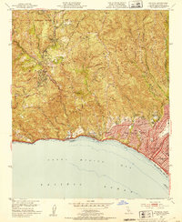
1952 Map of Topanga
USGS Topo · Published 1953About this map
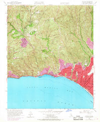
Santa Monica Mountains dominate this 1952 topographic study, where steep ridgelines like Henry Ridge and deep ravines like Temescal Canyon define the landscape before the heavy post-war suburban expansion. In the canyon bottoms, small settlements such as Topanga and Fernwood represent the rural character of the era, long before these areas were fully integrated into the greater Los Angeles metropolitan fabric. Along the coast, the planned community of Pacific Palisades begins to take shape, showing established landmarks like Corpus Christi Sch and Roosevelt Sch.
Find a feature on this map
46 named features on this map. Tap any name to fly to it.
Don’t see what you’re looking for? This feature index may not catch every label — zoom into the map to look around manually.
Map Details
Editions of this 1952 Topanga Map
8 editions found
Other maps of this area

1894 · Los Angeles
USGS Topo · 1:62,500

1896 · Redondo
USGS Topo · 1:62,500

1896 · Santa Monica
USGS Topo · 1:62,500

1898 · Santa Monica
USGS Topo · 1:62,500

1900 · Los Angeles
USGS Topo · 1:62,500

1901 · Southern California Sheet No. 1
USGS Topo · 1:250,000

1902 · Santa Monica
USGS Topo · 1:62,500

1903 · Calabasas
USGS Topo · 1:62,500

1903 · Camulos
USGS Topo · 1:125,000

1904 · Southern California Sheet No. 1
USGS Topo · 1:250,000