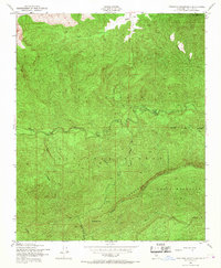
1943 Map of Topatopa Mountains
USGS Topo · Published 1967About this map
Los Padres National Forest dominates this 1943 survey, revealing the complex drainage systems of the southern California backcountry during World War II. The network centers on Sespe Creek and its various tributaries, including Mutau Creek and the West Fork Sespe Creek, which carve deep through the mountainous terrain. The map identifies specific operational and transit points for forest management, most notably the Hartman Guard Station BM 2472 and several distinct level areas such as Mutau Flat and Ten Sycamore Flat.
Find a feature on this map
22 named features on this map. Tap any name to fly to it.
Don’t see what you’re looking for? This feature index may not catch every label — zoom into the map to look around manually.
Map Details
Editions of this 1943 Topatopa Mountains Map
3 editions found
Other maps of this area

1900 · Piru
USGS Topo · 1:62,500

1903 · Santa Paula
USGS Topo · 1:62,500

1903 · Mt. Pinos
USGS Topo · 1:125,000

1903 · Tejon
USGS Topo · 1:125,000

1903 · Camulos
USGS Topo · 1:125,000

1921 · Piru
USGS Topo · 1:62,500

1941 · Piru
USGS Topo · 1:62,500

1942 · Santa Paula
USGS Topo · 1:62,500

1943 · Topatopa Mountains
USGS Topo · 1:24,000

1943 · San Guillermo
USGS Topo · 1:24,000