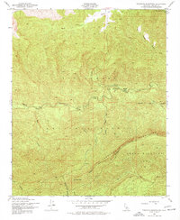
1943 Map of Topatopa Mountains
USGS Topo · Published 1977About this map
Los Padres National Forest dominates this mid-century survey of the Ventura County high country, where the Topatopa Mountains reach their heights at Hines Peak and San Rafael Peak. The 1943 field check documents a wilderness landscape managed by the Hartman Guard Station, situated at the junction of Sespe Creek and Sycamore Creek. This era of the backcountry is defined by a network of drainage systems, including Bear Canyon and Red Reef Canyon, and isolated level grounds such as Mutau Flat and Ten Sycamore Flat.
Find a feature on this map
23 named features on this map. Tap any name to fly to it.
Don’t see what you’re looking for? This feature index may not catch every label — zoom into the map to look around manually.
Map Details
Editions of this 1943 Topatopa Mountains Map
3 editions found
Other maps of this area

1900 · Piru
USGS Topo · 1:62,500

1903 · Santa Paula
USGS Topo · 1:62,500

1903 · Mt. Pinos
USGS Topo · 1:125,000

1903 · Tejon
USGS Topo · 1:125,000

1903 · Camulos
USGS Topo · 1:125,000

1921 · Piru
USGS Topo · 1:62,500

1941 · Piru
USGS Topo · 1:62,500

1942 · Santa Paula
USGS Topo · 1:62,500

1943 · Topatopa Mountains
USGS Topo · 1:24,000

1943 · San Guillermo
USGS Topo · 1:24,000