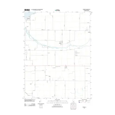
2012 Map of Topeka
USGS Topo · Published 2012About this map
Topeka and the surrounding agricultural lands of Mason County are defined by a network of drainage ditches and rural cemeteries that map generations of family history. The landscape is marked by several burial grounds, including the Quiver Presbyterian Cem and Rakestraw Cem, which sit near the winding course of Quiver Cr. The map details the transition from natural waterways to engineered drainage systems like Biggs Ditch and Tomlin Ditch, essential for the region's productive soil. Aviation and conservation interests are represented by the Havana Airport and the sprawling Mason State Nursery located east of Eckard. Small clusters of settlement at Buzzville and Bishop connect via an extensive grid of county roads, while the Larry Barrett RLA Airport provides a specialized landing strip in the southern portion of the quadrangle.
Find a feature on this map
72 named features on this map. Tap any name to fly to it.
Don’t see what you’re looking for? This feature index may not catch every label — zoom into the map to look around manually.
Map Details
Editions of this 2012 Topeka Map
This is the sole edition of this map. No revisions or reprints were ever made.
Other maps of this area

1925 · Havana
USGS Topo · 1:62,500

1929 · Manito
USGS Topo · 1:62,500

1930 · Chandlerville
USGS Topo · 1:62,500

1932 · Chandlerville
USGS Topo · 1:62,500

1932 · Manito
USGS Topo · 1:62,500

1933 · Petersburg
USGS Topo · 1:62,500

1938 · Petersburg
USGS Topo · 1:62,500

1947 · St. David
USGS Topo · 1:24,000

1947 · Havana
USGS Topo · 1:24,000

1948 · St. David
USGS Topo · 1:24,000