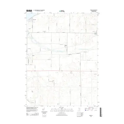
2015 Map of Topeka
USGS Topo · Published 2015About this map
Topeka and the surrounding plains of Mason County appear here as a landscape defined by highly organized agriculture and water management. This central Illinois region is crisscrossed by a grid of rural roads and extensive drainage systems, most notably the Mason Tazewell Drainage Ditch and Biggs Ditch, which converted the natural prairie and wetlands into productive farmland. For genealogists, the map is remarkably dense with small burial grounds tucked among the fields, including Quiver Presbyterian Cem, Rakestraw Cem, and Samm's Cem. The small settlements of Buzzville, Bishop, and Eckard anchor the rural community, connected by routes like E Manito Rd. Near the western edge, the natural curves of Quiver Creek and McHarry Pond offer a contrast to the geometric precision of the irrigation and road networks that dominate the quadrangle.
Find a feature on this map
56 named features on this map. Tap any name to fly to it.
Don’t see what you’re looking for? This feature index may not catch every label — zoom into the map to look around manually.
Map Details
Editions of this 2015 Topeka Map
This is the sole edition of this map. No revisions or reprints were ever made.
Other maps of this area

1925 · Havana
USGS Topo · 1:62,500

1929 · Manito
USGS Topo · 1:62,500

1930 · Chandlerville
USGS Topo · 1:62,500

1932 · Chandlerville
USGS Topo · 1:62,500

1932 · Manito
USGS Topo · 1:62,500

1933 · Petersburg
USGS Topo · 1:62,500

1938 · Petersburg
USGS Topo · 1:62,500

1947 · St. David
USGS Topo · 1:24,000

1947 · Havana
USGS Topo · 1:24,000

1948 · St. David
USGS Topo · 1:24,000