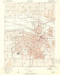
1951 Map of Topeka
USGS Topo · Published 1951About this map
The Kansas River divides this mid-century capital city, shaping a landscape defined by an extensive rail network and numerous public institutions. The heavy industrial and transit presence is marked by lines of the Atchison Topeka and Santa Fe and the Union Pacific, which converge near the riverbanks. The city's social infrastructure is deeply mapped, featuring landmark facilities like the Winter Veterans Hospital, Washburn University, and the State Hospital.
Find a feature on this map
72 named features on this map. Tap any name to fly to it.
Don’t see what you’re looking for? This feature index may not catch every label — zoom into the map to look around manually.
Map Details
Editions of this 1951 Topeka Map
2 editions found

Other maps of this area

1889 · Burlingame
USGS Topo · 1:125,000

1889 · Topeka
USGS Topo · 1:125,000

1894 · Burlingame
USGS Topo · 1:125,000

1894 · Topeka
USGS Topo · 1:125,000

1947 · Lawrence
USGS Topo · 1:250,000

1950 · Kansas City
USGS Topo · 1:250,000

1950 · Lawrence
USGS Topo · 1:250,000

1950 · Topeka
USGS Topo · 1:24,000

1950 · Grantville
USGS Topo · 1:24,000

1951 · Grantville
USGS Topo · 1:24,000