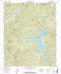
1957 Map of Topton
USGS Topo · Published 1984About this map
The Southern railroad line snakes through the mountainous terrain of the North Carolina high country, passing through the small community of Topton near the intersection of the Turnpike and Junaluska roads. This mid-century landscape is defined by the massive impoundment of Nantahala Lake, controlled by the Nantahala Dam and supported by infrastructure like the Dicks Creek Dam and a lengthy Nantahala Tunnel.
Find a feature on this map
122 named features on this map. Tap any name to fly to it.
Don’t see what you’re looking for? This feature index may not catch every label — zoom into the map to look around manually.
Map Details
Editions of this 1957 Topton Map
3 editions found
Other maps of this area

1933 · Bushnell
USGS Topo · 1:62,500

1935 · Rainbow Springs
USGS Topo · 1:24,000

1935 · Robbinsville
USGS Topo · 1:24,000

1935 · Shooting Creek
USGS Topo · 1:24,000

1935 · Burningtown Bald
USGS Topo · 1:24,000

1935 · Topton
USGS Topo · 1:24,000

1935 · Wayah Bald
USGS Topo · 1:48,000

1935 · Andrews
USGS Topo · 1:24,000
1935 · Hayesville
USGS Topo · 1:24,000

1936 · Wesser
USGS Topo · 1:24,000