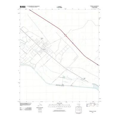
2010 Map of Tornillo
USGS Topo · Published 2010About this map
Rio Grande waters define the international border in this West Texas landscape, where the agricultural community of Tornillo sits amidst an intricate network of irrigation and drainage infrastructure. This 2010 survey details the complex water management systems essential for desert farming, including the Tornillo Canal, the Upper Tornillo Drain, and the Border Interceptor Drain. These features support a grid of fields and local industries like the Tornillo Feed Yards Airport.
Find a feature on this map
21 named features on this map. Tap any name to fly to it.
Don’t see what you’re looking for? This feature index may not catch every label — zoom into the map to look around manually.
Map Details
Editions of this 2010 Tornillo Map
This is the sole edition of this map. No revisions or reprints were ever made.
Other maps of this area

1894 · Fort Hancock
USGS Topo · 1:125,000

1896 · El Paso
USGS Topo · 1:125,000

1896 · Rio Grande
USGS Topo · 1:125,000

1903 · Cerro Alto
USGS Topo · 1:125,000

1908 · El Paso
USGS Topo · 1:125,000

1941 · Clint
USGS Topo · 1:62,500

1941 · Tornillo
USGS Topo · 1:62,500

1942 · Borrego
USGS Topo · 1:62,500

1943 · Fort Hancock
USGS Topo · 1:62,500
1945 · Clint
USGS Topo · 1:62,500