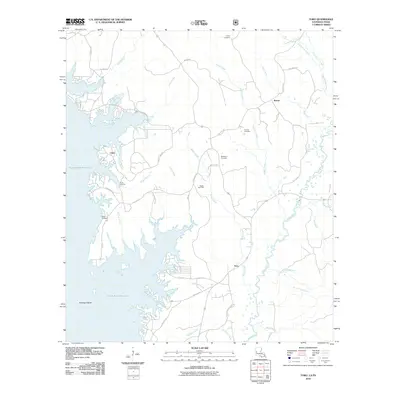
2010 Map of Toro
USGS Topo · Published 2010About this map
Toledo Bend Reservoir dominates the western portion of this Sabine Parish landscape, defining the jagged shoreline and numerous inlets that characterize the border between Louisiana and Texas. The community of Clare sits near the water's edge, while the small settlements of Rattan and Toro are situated further inland to the east. This era shows a rural region transitioning between water-based recreation and industrial extraction, evidenced by the presence of the Rattan Gas Field and several access points like H L B Landing and Kites Landing. The terrain is drained by a dense network of creeks, including Bayou Toro and Beaver Creek, which flow through the wooded tracts and lowlands. Local history is anchored by several family and community burial grounds, such as Victoria Cemetery, Caney Cemetery, and McMillion Cemetery, which remain as persistent landmarks amidst the newer developments of the reservoir area.
Find a feature on this map
57 named features on this map. Tap any name to fly to it.
Don’t see what you’re looking for? This feature index may not catch every label — zoom into the map to look around manually.
Map Details
Editions of this 2010 Toro Map
This is the sole edition of this map. No revisions or reprints were ever made.
Other maps of this area

1941 · Leesville
USGS Topo · 1:62,500

1942 · Florien
USGS Topo · 1:62,500

1943 · Leesville
USGS Topo · 1:62,500

1944 · Negreet
USGS Topo · 1:62,500

1944 · Wiergate
USGS Topo · 1:62,500

1944 · Florien
USGS Topo · 1:62,500

1946 · Leesville
USGS Topo · 1:62,500

1948 · Leesville
USGS Topo · 1:62,500

1948 · Wiergate
USGS Topo · 1:62,500

1953 · Alexandria
USGS Topo · 1:250,000