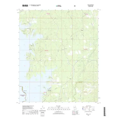
2020 Map of Toro
USGS Topo · Published 2020About this map
Toledo Bend Reservoir dominates the western landscape of this Sabine Parish region, its complex shoreline creating numerous points and coves like Robinson Bend and Toro Bay. This survey highlights a rural transition where the extensive woodlands of the Sabine National Forest meet the southern reaches of the Fort Polk military reservation. The settlement pattern is scattered, with small communities like Clare and Toro connected by a network of local roads such as Ferguson Rd and McNeely Rd.
Find a feature on this map
93 named features on this map. Tap any name to fly to it.
Don’t see what you’re looking for? This feature index may not catch every label — zoom into the map to look around manually.
Map Details
Editions of this 2020 Toro Map
This is the sole edition of this map. No revisions or reprints were ever made.
Other maps of this area

1941 · Leesville
USGS Topo · 1:62,500

1942 · Florien
USGS Topo · 1:62,500

1943 · Leesville
USGS Topo · 1:62,500

1944 · Negreet
USGS Topo · 1:62,500

1944 · Wiergate
USGS Topo · 1:62,500

1944 · Florien
USGS Topo · 1:62,500

1946 · Leesville
USGS Topo · 1:62,500

1948 · Leesville
USGS Topo · 1:62,500

1948 · Wiergate
USGS Topo · 1:62,500

1953 · Alexandria
USGS Topo · 1:250,000