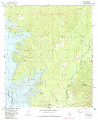
1985 Map of Toro
USGS Topo · Published 1985About this map
The Toledo Bend Reservoir dominates the western landscape of this mid-1980s survey, its flooded reaches stretching into the Sabine National Forest and defining the boundary between Louisiana and Texas. This area of the Sabine and Vernon Parish line is characterized by a dense network of tributaries including Bayou Toro, Beaver Creek, and Horsepen Creek that feed the massive impoundment. Small rural communities like Toro and Clare are situated near the water's edge, while Rattan sits further inland among the creek valleys.
Find a feature on this map
39 named features on this map. Tap any name to fly to it.
Don’t see what you’re looking for? This feature index may not catch every label — zoom into the map to look around manually.
Map Details
Editions of this 1985 Toro Map
This is the sole edition of this map. No revisions or reprints were ever made.
Other maps of this area

1941 · Leesville
USGS Topo · 1:62,500

1942 · Florien
USGS Topo · 1:62,500

1943 · Leesville
USGS Topo · 1:62,500

1944 · Negreet
USGS Topo · 1:62,500

1944 · Wiergate
USGS Topo · 1:62,500

1944 · Florien
USGS Topo · 1:62,500

1946 · Leesville
USGS Topo · 1:62,500

1948 · Leesville
USGS Topo · 1:62,500

1948 · Wiergate
USGS Topo · 1:62,500

1953 · Alexandria
USGS Topo · 1:250,000