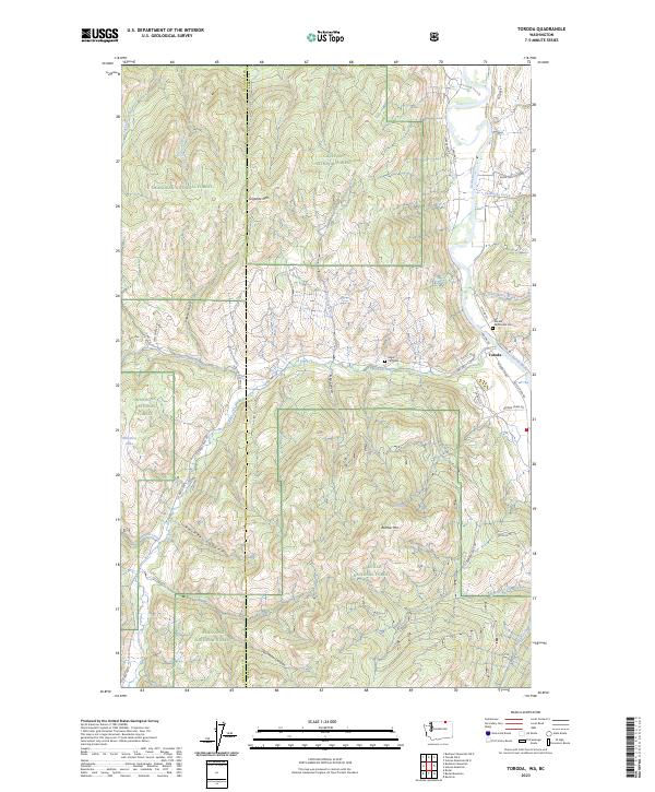
2023 Map of Toroda
USGS Topo · Published 2023About this map
Okanogan National Forest and Colville National Forest dominate this landscape along the Okanogan Co Ferry Co line, where the terrain is carved by complex drainages like Gila Canyon and Resner Canyon. The settlement of Toroda serves as a small focal point near the confluence of Toroda Creek and the northward-flowing Kettle River, an area where local infrastructure follows the narrow river valley floor. High-elevation points like Graphite Mtn and Bamber Mtn overlook a network of forest service roads and local routes such as Customs Rd, which points to the area's proximity to the international border. Genealogists will find the Ranald McDonald Cem located near the river, a notable landmark in a region defined by its timber and mining geography. The presence of Eagle Cliff Gem and Wheaton Lake further emphasizes the remote and specialized nature of this mountainous corner of Washington state.
Find a feature on this map
47 named features on this map. Tap any name to fly to it.
Don’t see what you’re looking for? This feature index may not catch every label — zoom into the map to look around manually.
Map Details
Editions of this 2023 Toroda Map
This is the sole edition of this map. No revisions or reprints were ever made.
Other maps of this area

1904 · Republic
USGS Topo · 1:125,000

1948 · Curlew
USGS Topo · 1:62,500

1951 · Curlew
USGS Topo · 1:62,500

1951 · Bodie Mountain
USGS Topo · 1:62,500

1954 · Okanogan
USGS Topo · 1:250,000

1958 · Okanogan
USGS Topo · 1:250,000

1958 · Bodie Mtn
USGS Topo · 1:62,500

1984 · Republic
USGS Topo · 1:100,000
1988 · Vulcan Mountain
USGS Topo · 1:24,000
1988 · Buckhorn Mountain
USGS Topo · 1:24,000