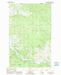
1988 Map of Vulcan Mountain
USGS Topo · Published 1988About this map
The Kettle River defines the southern portion of this landscape, winding through a valley marked by several gravel operations. This territory within the Colville National Forest is characterized by high peaks such as Vulcan Mountain, White Mountain, and Snow Peak. The international boundary between the United States and Canada runs along the northern edge of the sheet, where the landscape of Ferry County, Washington, meets British Columbia. Numerous mountain streams, including Catherine Creek, Mary Tenas Creek, and Goosmus Creek, drain the high country toward the river below.
Find a feature on this map
23 named features on this map. Tap any name to fly to it.
Don’t see what you’re looking for? This feature index may not catch every label — zoom into the map to look around manually.
Map Details
Editions of this 1988 Vulcan Mountain Map
This is the sole edition of this map. No revisions or reprints were ever made.
Other maps of this area

1904 · Republic
USGS Topo · 1:125,000

1948 · Curlew
USGS Topo · 1:62,500

1951 · Curlew
USGS Topo · 1:62,500

1951 · Bodie Mountain
USGS Topo · 1:62,500

1954 · Okanogan
USGS Topo · 1:250,000

1958 · Okanogan
USGS Topo · 1:250,000

1958 · Bodie Mtn
USGS Topo · 1:62,500

1984 · Republic
USGS Topo · 1:100,000
1988 · Curlew
USGS Topo · 1:24,000
1988 · Malo
USGS Topo · 1:24,000