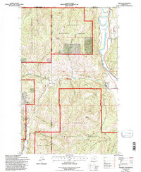
1992 Map of Toroda
USGS Topo · Published 1996About this map
The Kettle River meanders along the eastern edge of this northern Washington landscape, tracing a path just south of the international border. In the early 1990s, this region remained a transition point between the Okanogan National Forest and Colville National Forest, with the Okanogan Co Ferry Co line bisecting the rugged drainage basins. The small settlement of Toroda sits near the confluence of Toroda Creek and the river, while the tiny border outpost of Ferry marks the crossing into British Columbia. Cultural history is anchored by the Ranald MacDonald Historical Site near the riverbank.
Find a feature on this map
25 named features on this map. Tap any name to fly to it.
Don’t see what you’re looking for? This feature index may not catch every label — zoom into the map to look around manually.
Map Details
Editions of this 1992 Toroda Map
This is the sole edition of this map. No revisions or reprints were ever made.
Other maps of this area

1904 · Republic
USGS Topo · 1:125,000

1948 · Curlew
USGS Topo · 1:62,500

1951 · Curlew
USGS Topo · 1:62,500

1951 · Bodie Mountain
USGS Topo · 1:62,500

1954 · Okanogan
USGS Topo · 1:250,000

1958 · Okanogan
USGS Topo · 1:250,000

1958 · Bodie Mtn
USGS Topo · 1:62,500

1984 · Republic
USGS Topo · 1:100,000
1988 · Vulcan Mountain
USGS Topo · 1:24,000
1988 · Buckhorn Mountain
USGS Topo · 1:24,000