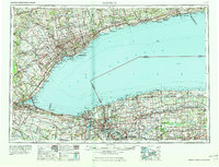
1965 Map of Toronto
USGS Topo · Published 1965About this map
Lake Ontario anchors this mid-century view of the international border between Ontario and New York, centered on the bustling Golden Horseshoe and the Niagara Frontier. The map captures a period of intense post-war expansion, with the Macdonald-Cartier Freeway and New York State Thruway facilitating rapid growth between major hubs like Toronto and Niagara Falls. Industrial and maritime arteries are prominent, including the engineering marvels of the Welland Canal and the historic Erie Canal winding through Lockport and Medina.
Find a feature on this map
126 named features on this map. Tap any name to fly to it.
Don’t see what you’re looking for? This feature index may not catch every label — zoom into the map to look around manually.
Map Details
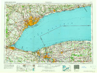
Editions of this 1965 Toronto Map
2 editions found
Other maps of this area

1894 · Buffalo
USGS Topo · 1:62,500

1894 · Niagara Falls
USGS Topo · 1:62,500

1894 · Wilson
USGS Topo · 1:62,500

1896 · Niagara Falls
USGS Topo · 1:62,500

1897 · Tonawanda
USGS Topo · 1:62,500

1897 · Albion
USGS Topo · 1:62,500

1897 · Olcott
USGS Topo · 1:62,500

1897 · Medina
USGS Topo · 1:62,500

1897 · Lockport
USGS Topo · 1:62,500

1897 · Oak Orchard
USGS Topo · 1:62,500