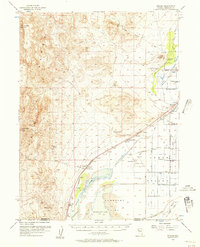
1956 Map of Toulon
USGS Topo · Published 1957About this map
The rugged Trinity Range dominates this landscape, rising above the arid basins of Humboldt Sink and the vast Humboldt Lake. This mid-century survey captures a corner of Nevada defined by the thin corridor of the Southern Pacific railroad and irrigation efforts in the Lower Peterson Valley. Water management is central to the area's survival, visible through the complex network of the Lakeshore Ditch, Westfall Ditch, and Seventeen Mile Ditch feeding local agricultural interests.
Find a feature on this map
54 named features on this map. Tap any name to fly to it.
Don’t see what you’re looking for? This feature index may not catch every label — zoom into the map to look around manually.
Map Details
Editions of this 1956 Toulon Map
4 editions found
Other maps of this area

1908 · Carson Sink
USGS Topo · 1:250,000

1910 · Carson Sink
USGS Topo · 1:250,000

1931 · Lovelock
USGS Topo · 1:250,000

1935 · Lovelock
USGS Topo · 1:250,000

1951 · Carson Sink
USGS Topo · 1:62,500

1951 · Desert Peak
USGS Topo · 1:62,500

1955 · Lovelock
USGS Topo · 1:250,000

1956 · Oreana
USGS Topo · 1:62,500

1956 · Toulon
USGS Topo · 1:62,500

1956 · Lovelock
USGS Topo · 1:62,500