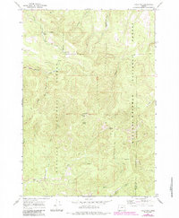
1967 Map of Tower Mtn
USGS Topo · Published 1984About this map
Tower Mtn dominates this high-altitude landscape along the border of Umatilla and Union Counties, its summit marked by the Tower Mtn Lookout Tower. The terrain is characterized by a dense network of water sources including Frazier Creek, Fly Creek, and Umapine Creek, reflecting the heavy timber and watershed value of the Umatilla National Forest. Historically, the area served as a remote base for forestry and recreation, evidenced by Wapiti Camp and the small settlement at Hidaway. The intricate trail system, including the Rock Creek Trail and Winom Trail, alongside the Cable Road, provides a clear view of how this rugged section of the Wallowa-Whitman National Forest was accessed and managed in the late 1960s before modern road development expanded.
Find a feature on this map
31 named features on this map. Tap any name to fly to it.
Don’t see what you’re looking for? This feature index may not catch every label — zoom into the map to look around manually.
Map Details
Editions of this 1967 Tower Mtn Map
2 editions found
Other maps of this area

1901 · Sumpter
USGS Topo · 1:125,000

1951 · Desolation Butte
USGS Topo · 1:62,500

1953 · Pendleton
USGS Topo · 1:250,000

1955 · Canyon City
USGS Topo · 1:250,000

1956 · Pendleton
USGS Topo · 1:250,000

1959 · Canyon City
USGS Topo · 1:250,000

1965 · Marley Creek
USGS Topo · 1:24,000

1965 · Fly Valley
USGS Topo · 1:24,000

1967 · Tower Mtn
USGS Topo · 1:24,000

1967 · Sullivan Gulch
USGS Topo · 1:24,000