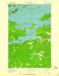
1956 Map of Tower
USGS Topo · Published 1960About this map
Lake Vermilion dominates the landscape of this mid-century survey, its complex shoreline defined by prominent landmarks like Birch Point and Hoodoo Point. The settlement of Tower serves as the regional anchor, situated where the Duluth Missabe and Iron Range railroad passes through Tower Junction. This era represents a period of industrial activity and northern recreation, evidenced by the North American Mine near the town center and the sprawling Superior National Forest boundaries to the north. Transport and utility are visible in the Pike River flow and the localized Landing Field. For researchers, the map details the transition from the concentrated grid of Tower to the remote clusters of islands such as the Isle of Pines and Ely Island, while the southern expanse includes the small community of Peyla and the Lakeview Cemetery.
Find a feature on this map
54 named features on this map. Tap any name to fly to it.
Don’t see what you’re looking for? This feature index may not catch every label — zoom into the map to look around manually.
Map Details
Editions of this 1956 Tower Map
4 editions found
Other maps of this area

1949 · Embarrass
USGS Topo · 1:24,000

1950 · Embarrass
USGS Topo · 1:24,000

1950 · Biwabik NW
USGS Topo · 1:24,000

1950 · Biwabik NE
USGS Topo · 1:24,000

1951 · Biwabik NE
USGS Topo · 1:24,000

1951 · Biwabik NW
USGS Topo · 1:24,000

1954 · Hibbing
USGS Topo · 1:250,000

1956 · Sioux Pine Island
USGS Topo · 1:24,000

1956 · Tower
USGS Topo · 1:24,000

1956 · Vermilion Dam
USGS Topo · 1:24,000