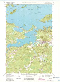
1956 Map of Tower
USGS Topo · Published 1986About this map
The town of Tower and its neighboring Tower Junction serve as the focal point for this survey of the southern reaches of Vermilion Lake. The landscape is a complex network of glacial waterways and islands, including the Isle of Pines and the expansive Pine Island, much of which falls within the Superior National Forest. Industrial and civic life is marked by the presence of the North American Mine and the transportation corridor provided by the Duluth Missabe and Iron Range railroad. Recreational development is evident along the shoreline at Hoodoo Point Campground and the Tower Municipal Landing Field. South of the lake, the terrain transitions into more forested areas drained by the Pike River, West Two River, and East Two River, where local landmarks like the Town Hall and Lakeview Cem indicate the community's established footprint in St. Louis County.
Find a feature on this map
49 named features on this map. Tap any name to fly to it.
Don’t see what you’re looking for? This feature index may not catch every label — zoom into the map to look around manually.
Map Details
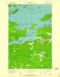
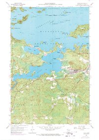
Editions of this 1956 Tower Map
4 editions found
Other maps of this area

1949 · Embarrass
USGS Topo · 1:24,000

1950 · Embarrass
USGS Topo · 1:24,000

1950 · Biwabik NW
USGS Topo · 1:24,000

1950 · Biwabik NE
USGS Topo · 1:24,000

1951 · Biwabik NE
USGS Topo · 1:24,000

1951 · Biwabik NW
USGS Topo · 1:24,000

1954 · Hibbing
USGS Topo · 1:250,000

1956 · Sioux Pine Island
USGS Topo · 1:24,000

1956 · Tower
USGS Topo · 1:24,000

1956 · Vermilion Dam
USGS Topo · 1:24,000