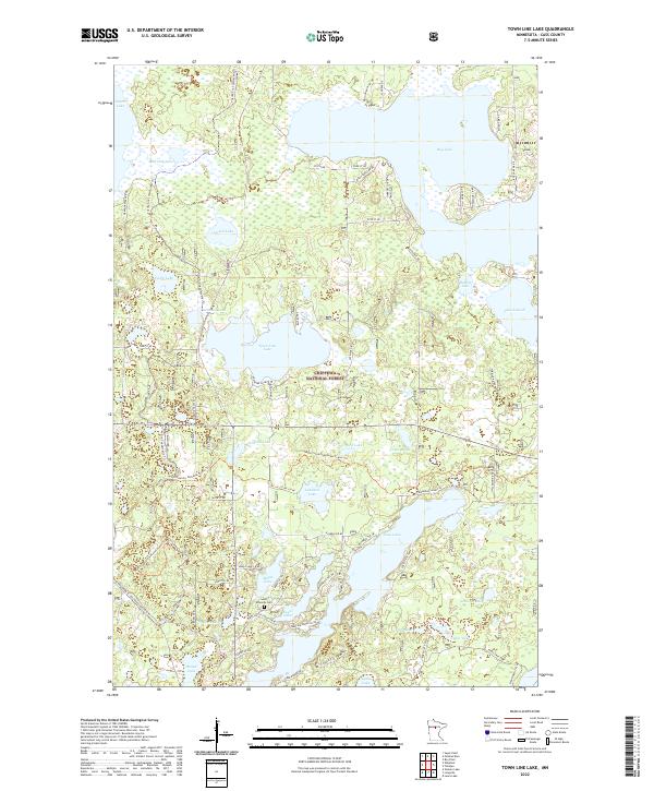
2022 Map of Town Line Lake
USGS Topo · Published 2022About this map
Chippewa National Forest dominates this northern Minnesota landscape, where a dense network of water bodies and recreational trails defines the local geography. Large lake systems including Leech Lake, Boy Lake, and the central Town Line Lake are connected by a web of local routes and specialized paths such as the North Country National Scenic Trl and the Triville Gia Snowmobile Trl. This concentration of water and woodland reflects the region's long-standing reliance on seasonal recreation and timber management. Genealogists and local historians can locate Saint Edwards Cem situated near Kego Lake, providing a specific point of interest among the numerous named basins like Iverson Lake and Rabbit Lake. The mapping reveals a modern road system including Co Rd 126 NE and Macemon Rd NE that provides access to these remote wetlands.
Find a feature on this map
71 named features on this map. Tap any name to fly to it.
Don’t see what you’re looking for? This feature index may not catch every label — zoom into the map to look around manually.
Map Details
Editions of this 2022 Town Line Lake Map
This is the sole edition of this map. No revisions or reprints were ever made.
Other maps of this area

1953 · Brainerd
USGS Topo · 1:250,000

1954 · Bemidji
USGS Topo · 1:250,000

1957 · Brainerd
USGS Topo · 1:250,000

1957 · Bemidji
USGS Topo · 1:250,000

1958 · Bemidji
USGS Topo · 1:250,000

1958 · Brainerd
USGS Topo · 1:250,000

1965 · Brainerd
USGS Topo · 1:250,000

1970 · Laura Lake
USGS Topo · 1:24,000

1970 · Woman Lake
USGS Topo · 1:24,000
1971 · Longville
USGS Topo · 1:24,000