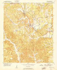
1951 Map of Townley
USGS Topo · Published 1951About this map
Townley serves as a central hub in this Walker County landscape, where the St Louis San Francisco Railway carves through a terrain of ridges and creek valleys. The early post-war industrial footprint is visible in the Strip Mine located north of town, indicating the importance of coal extraction to the local economy. Surrounding the town, numerous small communities and family-named landmarks are scattered across the hills, such as Cedrum and Holly Grove.
Find a feature on this map
77 named features on this map. Tap any name to fly to it.
Don’t see what you’re looking for? This feature index may not catch every label — zoom into the map to look around manually.
Map Details
Editions of this 1951 Townley Map
2 editions found

Other maps of this area

1893 · Jasper
USGS Topo · 1:125,000

1949 · Parrish
USGS Topo · 1:24,000

1949 · Townley
USGS Topo · 1:24,000

1949 · Jasper
USGS Topo · 1:24,000

1949 · Oakman
USGS Topo · 1:24,000

1949 · Manchester
USGS Topo · 1:24,000

1949 · Nauvoo
USGS Topo · 1:24,000

1950 · Nauvoo
USGS Topo · 1:24,000

1950 · Manchester
USGS Topo · 1:24,000

1951 · Jasper
USGS Topo · 1:24,000