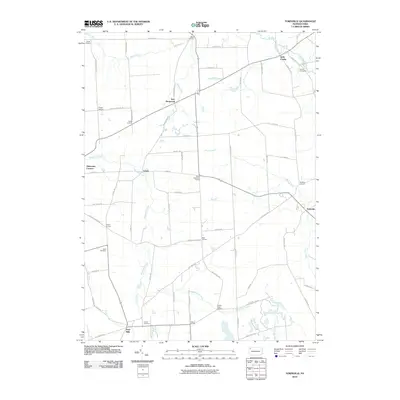
2010 Map of Townville
USGS Topo · Published 2010About this map
Townville and Guys Mills serve as the primary hubs in this corner of Crawford County, where the landscape is defined by a dense network of country roads connecting numerous named rural corners. This 2010 survey by the U. S. Geological Survey documents the enduring footprint of agricultural settlements such as New Richmond, Lyona, and Little Cooley. The geography is characterized by the branching paths of Woodcock Creek, Muddy Creek, and West Branch Sugar Creek, which navigate the terrain between family-named landmarks like Jewel Corners and Oregon Corners.
Find a feature on this map
67 named features on this map. Tap any name to fly to it.
Don’t see what you’re looking for? This feature index may not catch every label — zoom into the map to look around manually.
Map Details
Editions of this 2010 Townville Map
This is the sole edition of this map. No revisions or reprints were ever made.
Other maps of this area

1923 · Meadville
USGS Topo · 1:62,500

1923 · Cambridge Springs
USGS Topo · 1:62,500

1925 · Meadville
USGS Topo · 1:62,500

1925 · Cambridge Springs
USGS Topo · 1:62,500

1927 · Townville
USGS Topo · 1:48,000

1929 · Union City
USGS Topo · 1:62,500

1932 · Townville
USGS Topo · 1:62,500

1932 · Union City
USGS Topo · 1:62,500

1943 · Meadville
USGS Topo · 1:62,500

1943 · Cambridge Springs
USGS Topo · 1:62,500