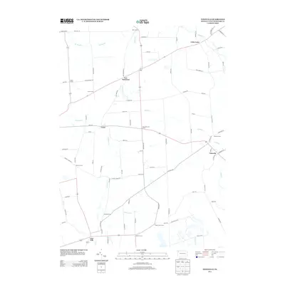
2013 Map of Townville
USGS Topo · Published 2013About this map
Townville and the surrounding rural communities of Crawford County are defined by a network of creeks and numerous historic crossroads settlements. In the early 2010s, this landscape retained its traditional character with clusters of homes and small hubs like New Richmond, Lyona, and Guys Mills serving as local anchors. The drainage pattern is complex, with Muddy Cr winding through the northern reaches while Woodcock Cr and Sugar Cr carve through the southern and eastern portions of the quadrangle. These waterways historically influenced the placement of early homesteads and road routes. The map documents many smaller named junctions, such as Turkey Track Corners and Buckley Corners, which preserve the names of local families and the specific geography of this Pennsylvania countryside. A dense grid of local thoroughfares like John Brown Rd and Teepleville Rd connects these scattered hamlets, tracing the lineage of rural development in the region.
Find a feature on this map
75 named features on this map. Tap any name to fly to it.
Don’t see what you’re looking for? This feature index may not catch every label — zoom into the map to look around manually.
Map Details
Editions of this 2013 Townville Map
This is the sole edition of this map. No revisions or reprints were ever made.
Other maps of this area

1923 · Meadville
USGS Topo · 1:62,500

1923 · Cambridge Springs
USGS Topo · 1:62,500

1925 · Meadville
USGS Topo · 1:62,500

1925 · Cambridge Springs
USGS Topo · 1:62,500

1927 · Townville
USGS Topo · 1:48,000

1929 · Union City
USGS Topo · 1:62,500

1932 · Townville
USGS Topo · 1:62,500

1932 · Union City
USGS Topo · 1:62,500

1943 · Meadville
USGS Topo · 1:62,500

1943 · Cambridge Springs
USGS Topo · 1:62,500