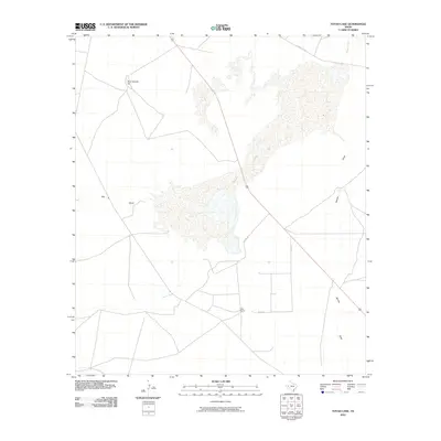
2010 Map of Toyah Lake
USGS Topo · Published 2010About this map
Toyah Lake dominates this Reeves County landscape, appearing as a significant ephemeral water body in a region defined by arid drainage patterns. The 2010 survey illustrates the transition of water through the desert via Toyah Creek and Salt Draw, which feed into the primary lake basin and the nearby Dry Salt Lake to the north. These features highlight the alkaline environment and the intermittent nature of West Texas hydrology. Settlement is sparse, anchored by the Lake Ranch located south of the main lake bed, illustrating the pastoral land use that persists despite the challenging terrain. The area is traversed by Farm Rd 1450 and local routes like Co Rd 113, which navigate around prominent landmarks such as Blue Goose Hill. This map provides a detailed view of the natural and man-made infrastructure in this remote corner of the Trans-Pecos.
Find a feature on this map
10 named features on this map. Tap any name to fly to it.
Don’t see what you’re looking for? This feature index may not catch every label — zoom into the map to look around manually.
Map Details
Editions of this 2010 Toyah Lake Map
This is the sole edition of this map. No revisions or reprints were ever made.
Other maps of this area

1921 · Toyah
USGS Topo · 1:125,000

1931 · Barstow
USGS Topo · 1:125,000

1954 · Pecos
USGS Topo · 1:250,000

1955 · Saragosa
USGS Topo · 1:62,500

1957 · Pecos
USGS Topo · 1:250,000

1963 · Old X Ranch
USGS Topo · 1:24,000

1963 · Quito Draw
USGS Topo · 1:24,000

1963 · Pecos East
USGS Topo · 1:24,000

1963 · Toyah Lake
USGS Topo · 1:24,000

1970 · Barstow 3 NE
USGS Topo · 1:24,000