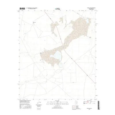
2016 Map of Toyah Lake
USGS Topo · Published 2016About this map
Blue Goose Hill rises as a prominent landmark in this portion of Reeves County, overlooking an arid landscape defined by ephemeral watercourses and vital desert water sources. The Toyah Cr drainage system and the secluded Hackberry Springs reflect the critical reliance on water for ranching and survival in the Trans-Pecos region. This 2016 survey captures the intricate network of drainage basins, including the extensive sediment patterns of Salt Draw and Barrilla Draw, which funnel seasonal runoff across the basin. Transportation is represented by the north-south corridor of Route 285 and a grid of secondary routes like Farm Rd 1450, Co Rd 114, and Co Rd 113, illustrating how modern infrastructure follows the older topographic contours of the Texas plains.
Find a feature on this map
9 named features on this map. Tap any name to fly to it.
Don’t see what you’re looking for? This feature index may not catch every label — zoom into the map to look around manually.
Map Details
Editions of this 2016 Toyah Lake Map
This is the sole edition of this map. No revisions or reprints were ever made.
Other maps of this area

1921 · Toyah
USGS Topo · 1:125,000

1931 · Barstow
USGS Topo · 1:125,000

1954 · Pecos
USGS Topo · 1:250,000

1955 · Saragosa
USGS Topo · 1:62,500

1957 · Pecos
USGS Topo · 1:250,000

1963 · Old X Ranch
USGS Topo · 1:24,000

1963 · Quito Draw
USGS Topo · 1:24,000

1963 · Pecos East
USGS Topo · 1:24,000

1963 · Toyah Lake
USGS Topo · 1:24,000

1970 · Barstow 3 NE
USGS Topo · 1:24,000