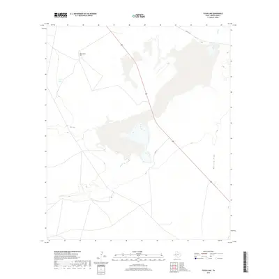
2019 Map of Toyah Lake
USGS Topo · Published 2019About this map
Toyah Cr and Salt Draw define the drainage patterns across this arid stretch of Reeves County, leading toward the central wetland basin. The landscape is marked by subtle but distinct landmarks like Blue Goose Hill, which rises above the surrounding plains. This modern survey illustrates the sparse infrastructure characteristic of the Trans-Pecos region, where transportation is centered on long corridors such as Highway 285 and Farm Rd 1450. The presence of Hackberry Springs highlights the critical importance of isolated water sources in this high-desert environment, while the intricate network of local tracks like Co Rd 114 provides access to the ranchlands and draws that segment the terrain.
Find a feature on this map
8 named features on this map. Tap any name to fly to it.
Don’t see what you’re looking for? This feature index may not catch every label — zoom into the map to look around manually.
Map Details
Editions of this 2019 Toyah Lake Map
This is the sole edition of this map. No revisions or reprints were ever made.
Other maps of this area

1921 · Toyah
USGS Topo · 1:125,000

1931 · Barstow
USGS Topo · 1:125,000

1954 · Pecos
USGS Topo · 1:250,000

1955 · Saragosa
USGS Topo · 1:62,500

1957 · Pecos
USGS Topo · 1:250,000

1963 · Old X Ranch
USGS Topo · 1:24,000

1963 · Quito Draw
USGS Topo · 1:24,000

1963 · Pecos East
USGS Topo · 1:24,000

1963 · Toyah Lake
USGS Topo · 1:24,000

1970 · Barstow 3 NE
USGS Topo · 1:24,000